When viewing a Property Report, select the View Larger Map link to see a more detailed view of the property’s surrounding area. CRS maps provide a variety of layers and tools that give you additional information about that area like recent sales, foreclosures, listings, and more.
Layers
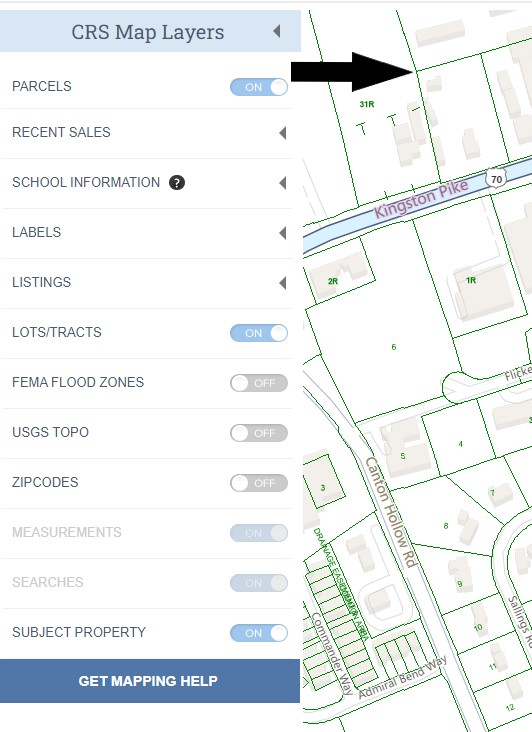
Let’s take a detailed look at the layers available to you. Start by selecting CRS Map Layers in the upper left corner to see your options.
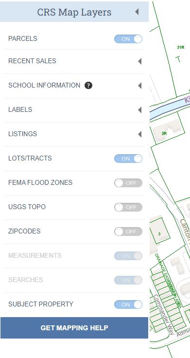
Parcels
Show or hide the parcel (property boundary) lines on the map.
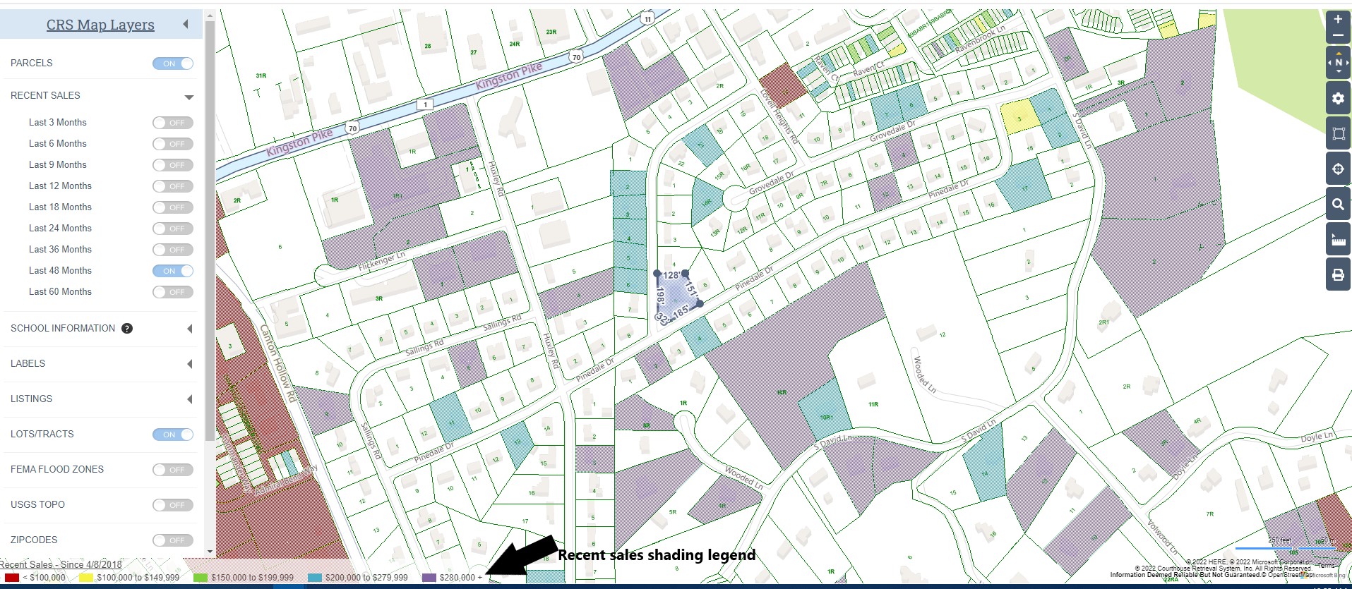
Recent Sales
Highlight properties that have sold within certain timeframes by turning on or off recent sales layers.
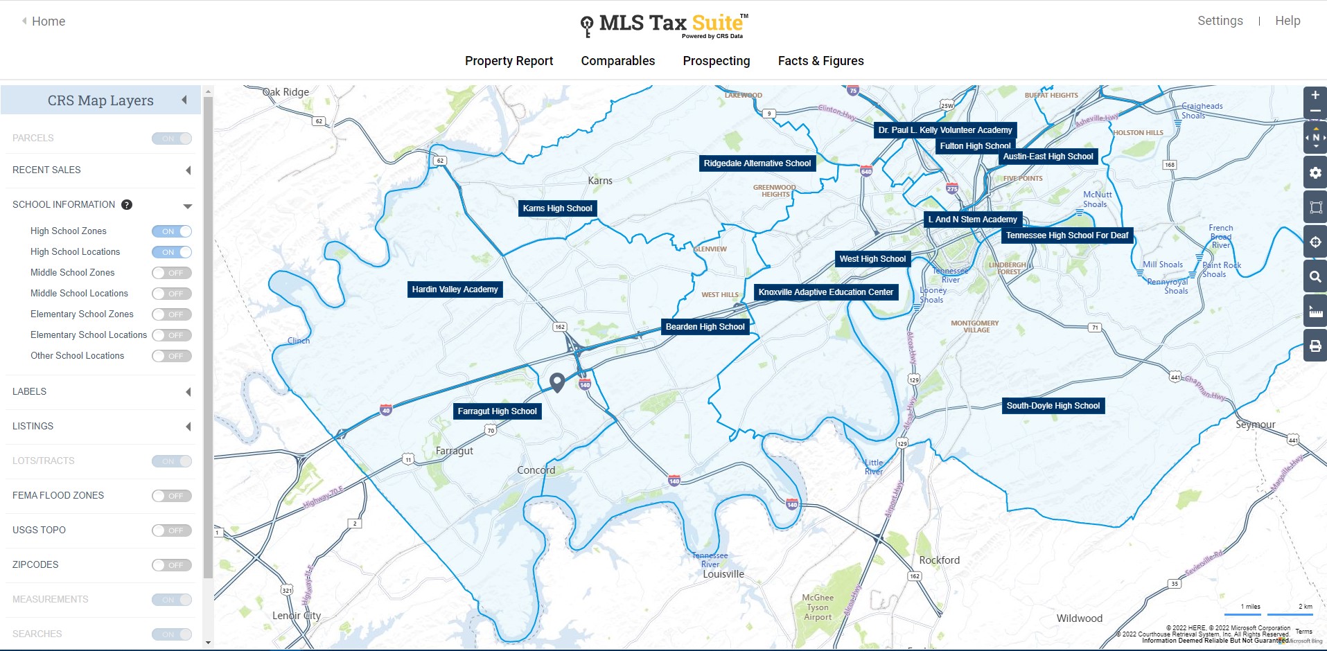
School Information
School Zone options show the boundaries for public schools and Location options show where schools are located.
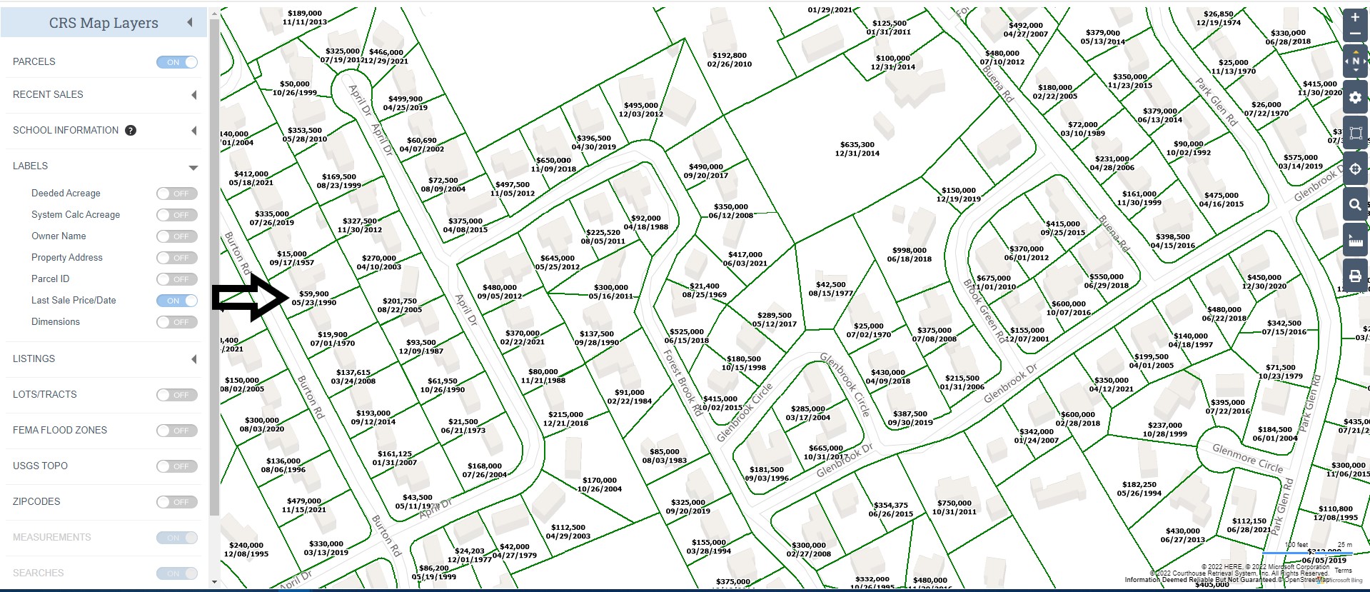
Labels
Turn on or off various labels to enhance the current view.
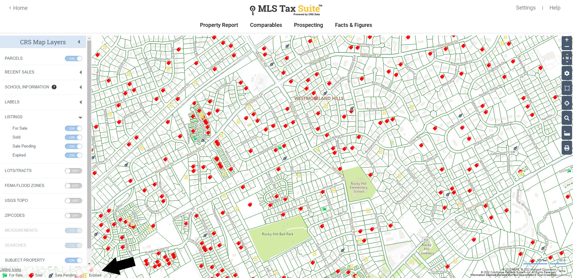
Listings
Show or hide listing statuses for properties by turning the listing layers on or off.
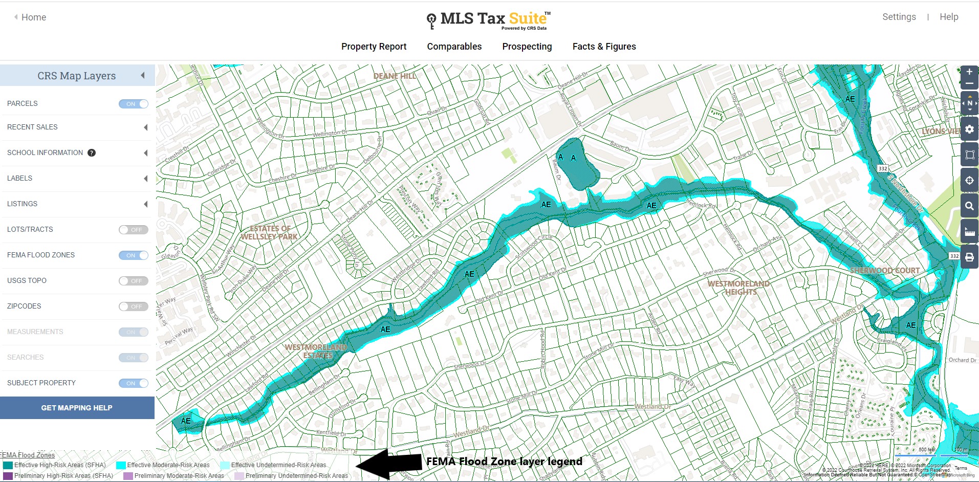
FEMA Flood Zone
Investigate whether a property is located in a flood zone by turning on the FEMA Flood Zone Layer. For further information about the flood zone refer to the property report FEMA section.
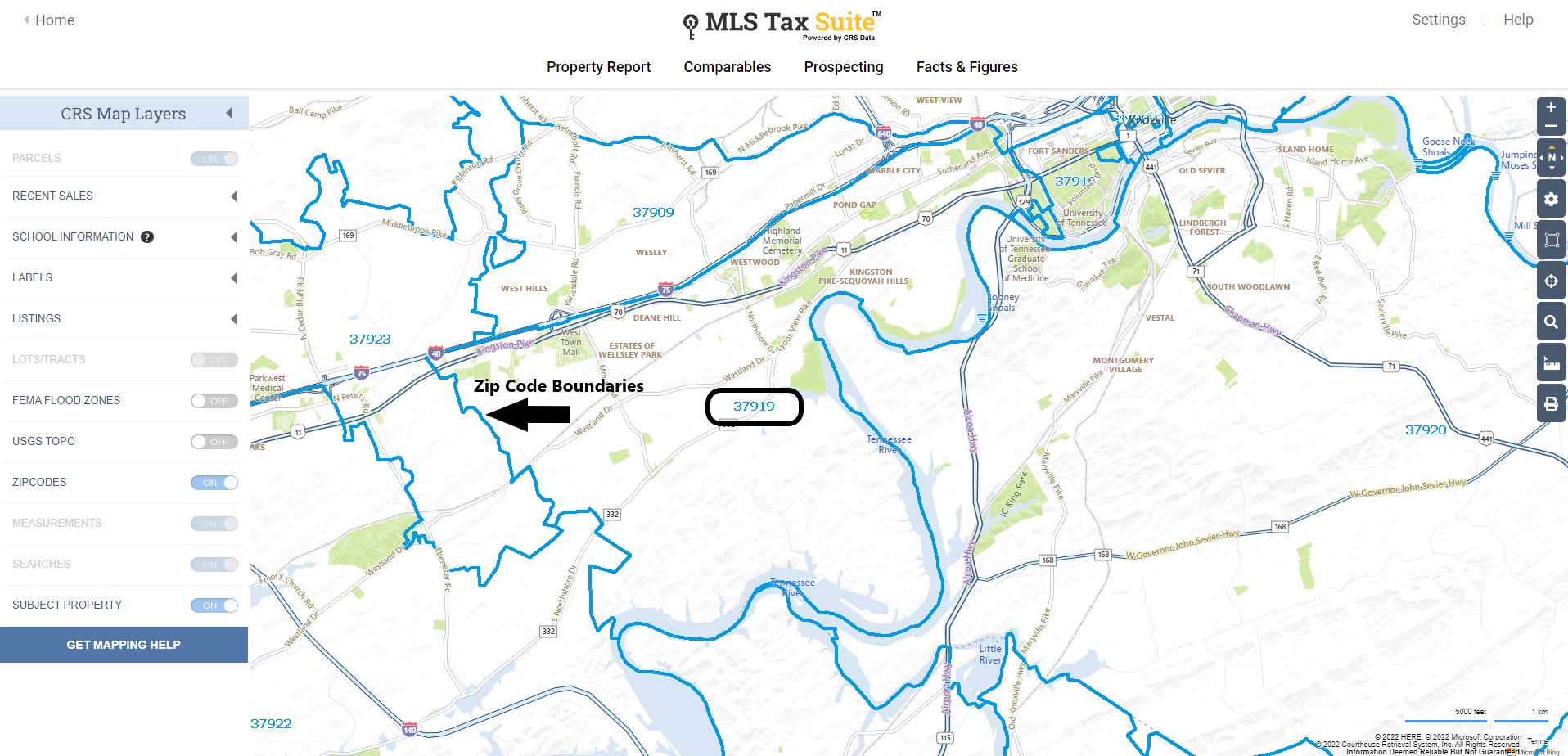
Zip Code
Measurements
If you have measured anything on the map using the tools below, you can turn off those measurements using this switch.
Searches
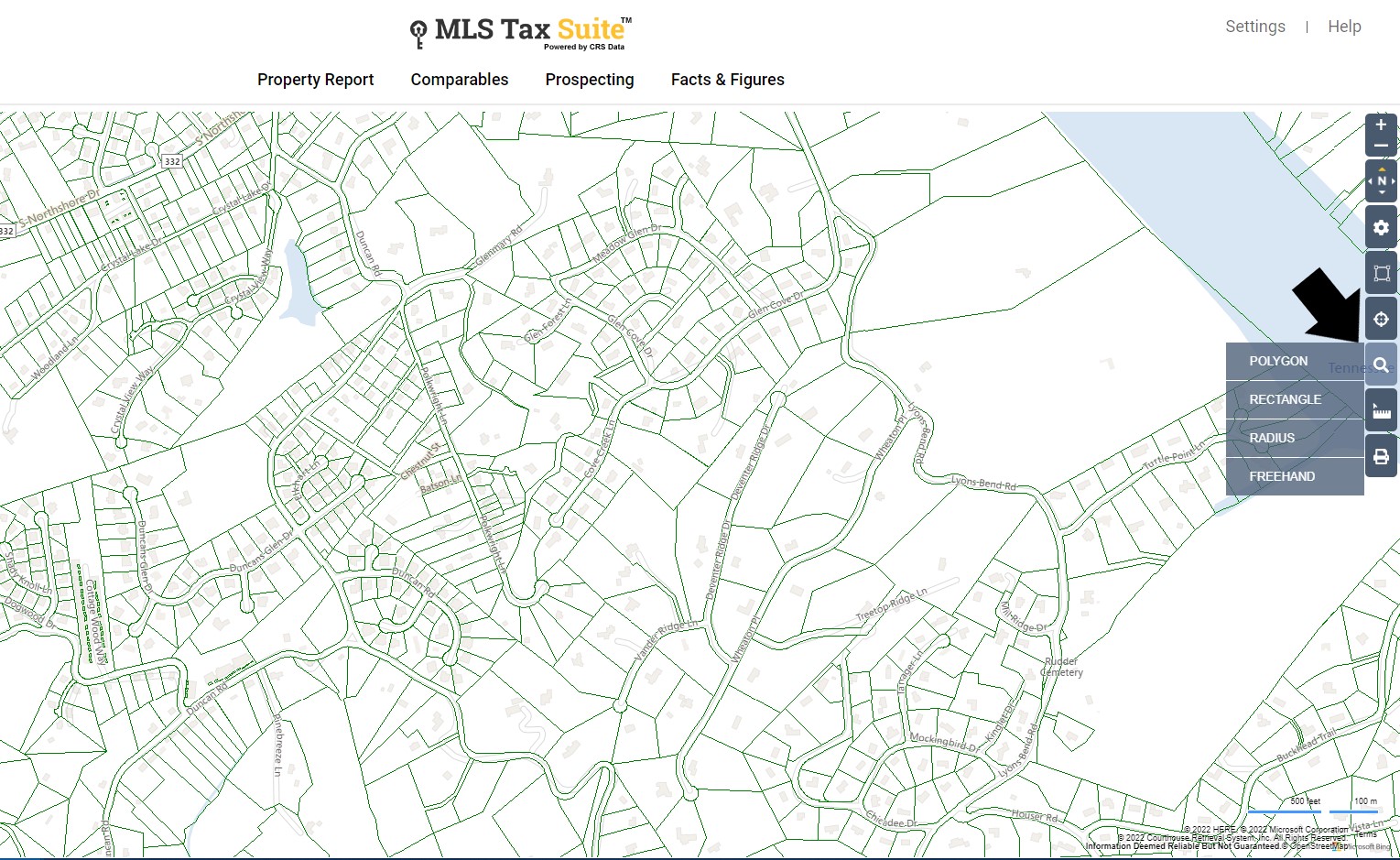
If you have drawn any shapes (rectangle, radius, or polygon) on the map, you can hide the shapes by turning off the Searches layer.
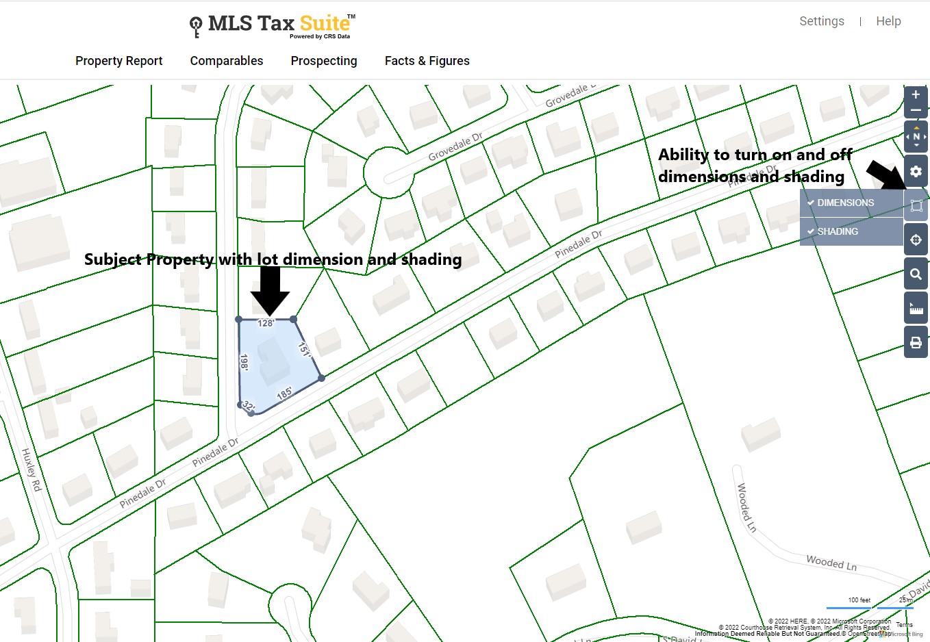
Subject Property
Show or hide the icon that indicates the subject property. This is the property you were viewing when you selected to view the large map.
Map View Tools
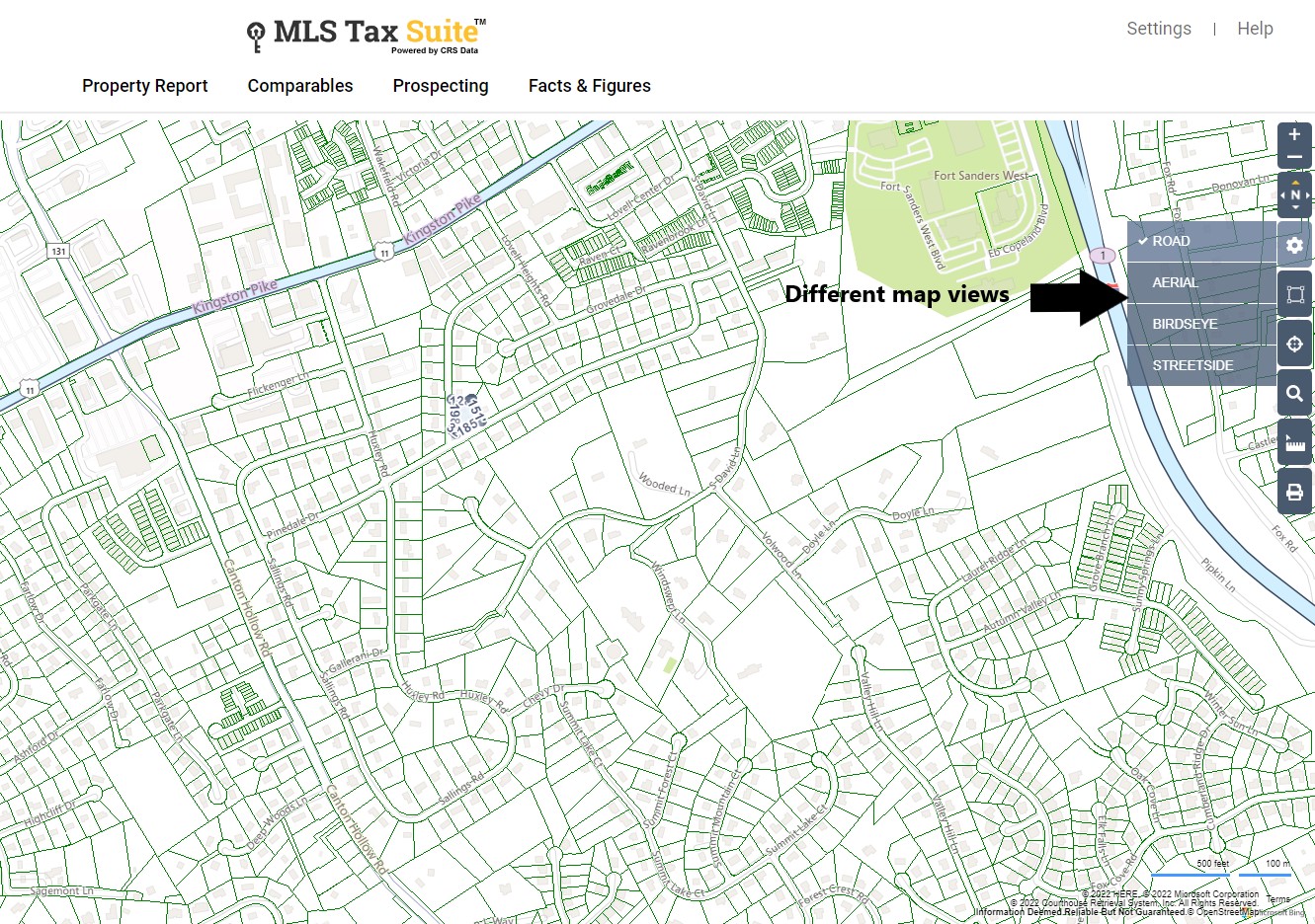
Select the gear icon to see different types of maps, Road, Aerial, and Birdseye. When in Birdseye view you will see the arrow icons shown in the image below, use these to rotate the map view.
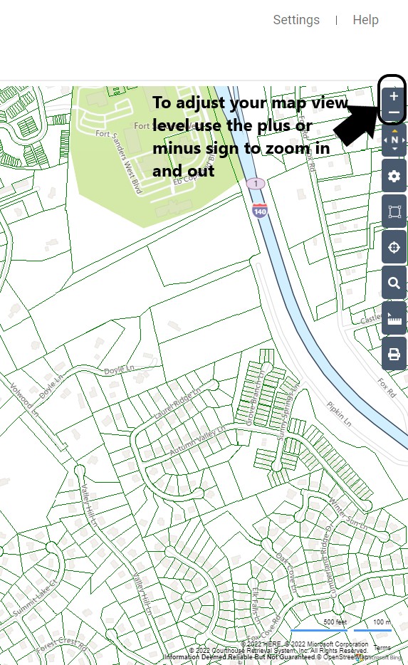
Zoom in and out
Select the plus sign to zoom in and the minus sign to zoom out.
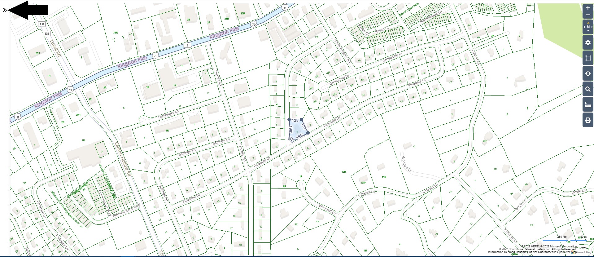
Compass Icon
The compass icon shows you the direction the map is facing. The orange arrow points north. When in Birdseye view, your view can be rotated, this is how you’ll know the current map view's orientation.
“You are right, it doesn’t do anything. Its purpose is to show which direction you are facing. If you switch to the Birdseye view then you are given two additional buttons to rotate the image. Again the actual icon doesn’t do anything though.”
![]()
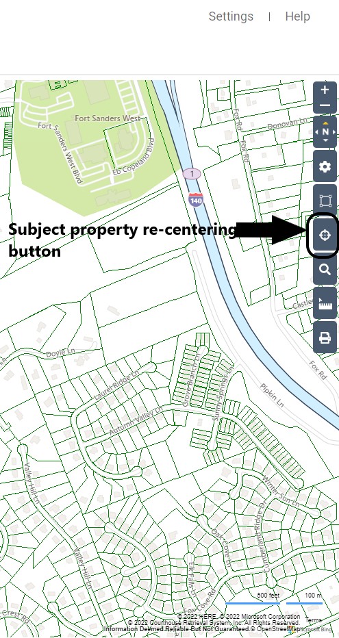
Re-center on subject property
If you have moved the map and would like to quickly re-position it back to your subject property, just select the map location icon (shown below).
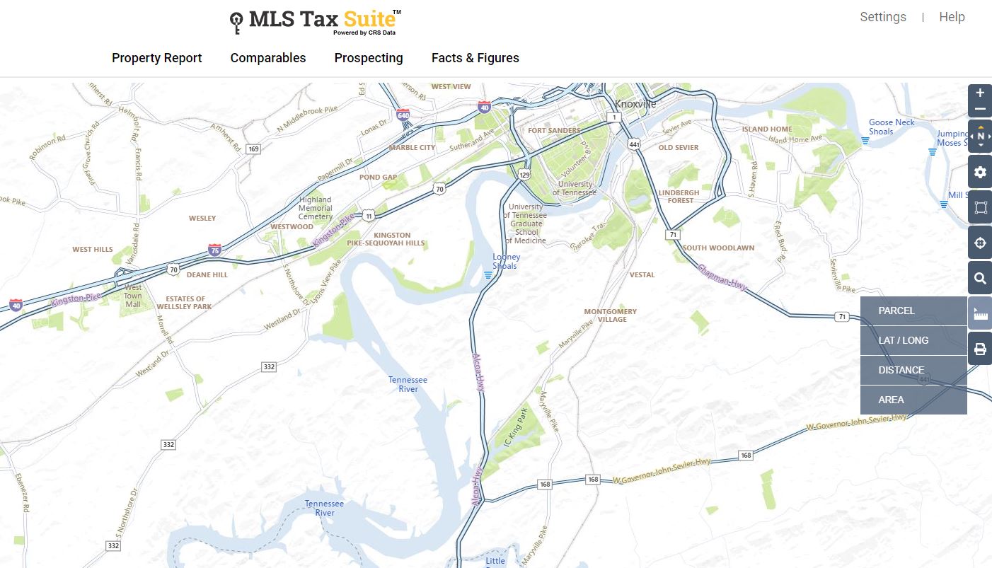
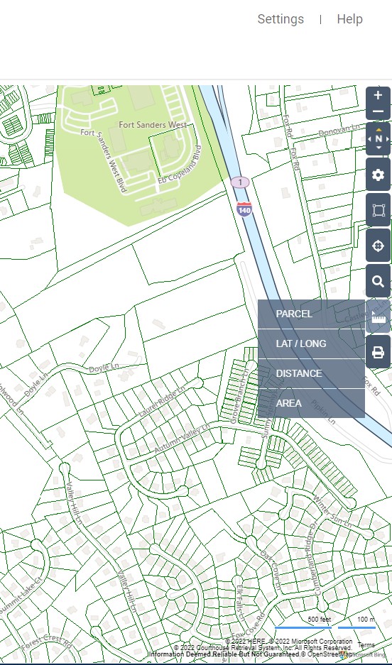
Measuring Tool
To measure distances on the map, select the ruler icon and choose the measurement type you need.
Lat/Long
Use the Lat/Long option to see map coordinates. Once you choose this option, move your pointer to the spot on the map you need to measure, then click or tap once. A box will appear giving you the coordinates. select Delete to remove it or Move to choose a new spot on the map.
Distance
To measure a distance, select the ruler icon and choose Distance. Click or tap on your starting point, then move the red line to any other point on the map to see how far apart they are. Double-click or tap at your end point to finish your measurement.
Area
Select the ruler icon then Area to measure the area of the map. After choosing the Area tool, click or tap on your starting point, move the red line to the next point on the edge of your area, the click or tap again. Continue adding connecting lines in this manner until you close off the area to be measured. Double-click or tap to finish your measurement. The acreage will be shown in the middle of your selection.
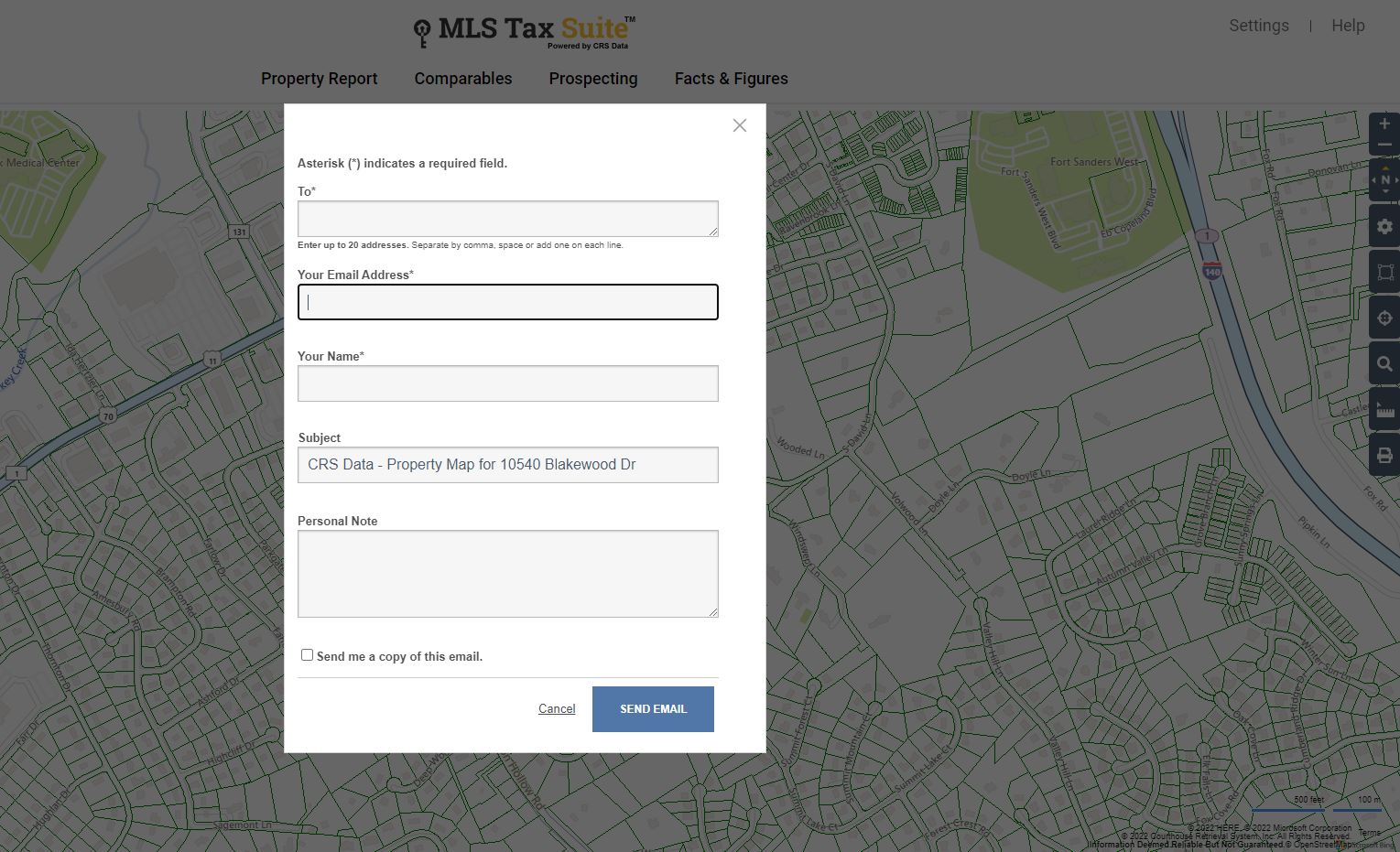
Print, email, save
Select the printer icon to Print your current map view, Email a copy of it, Save a PDF to your computer, or Copy an image of the map to paste into another document.
NOTE: the ability to print, email, save, or copy is not available when in Birdseye view. This is in compliance with Microsoft Bing Map license.
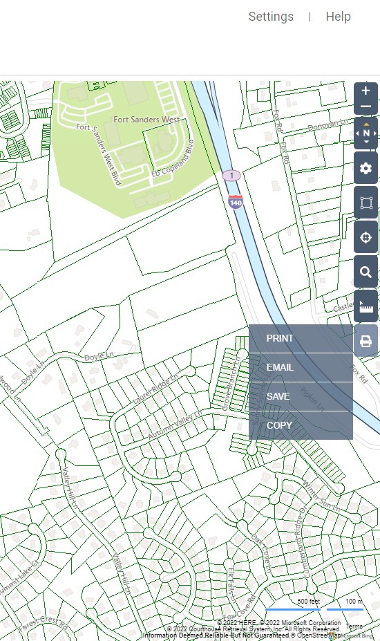
If you choose the Email option, just enter your recipient’s email address (up to 20 recipients), edit your From email if necessary, edit the subject line, and enter a message to be included in the email. You can also choose to receive a copy of the email at your own address.